
The Ons archipelago, together with the archipelagos of Cíes, Sálvora and Cortegada, is part of the Atlantic Islands of Galicia National Park, which protects one of the best examples of Atlantic coastal ecosystems.
The self-guided route The Names of the Island follows the South Route, marked in green on the map, and introduces us—through place names—to the island’s natural and cultural wealth. Wooden posts with a green stripe and an arrow will show you the way. Those with a number indicate a designated stop.
If you prefer, you can download the complete self-guided route leaflet in PDF format HERE. ![]()
The place names of Ons reveal the deep connection between its inhabitants and the surrounding nature.
The isolation of Ons’ population—especially in winter, due to rough sea conditions—increased their dependence on the environment they lived in. This fostered the existence and survival, to this day, of a vast number of place names (toponyms), which made it possible to locate springs, hills, headlands or submerged rocks with precision. This geographic knowledge had to be preserved in both collective and individual memory to ensure essential daily tasks like finding food or fresh water.
By analysing the island’s toponyms, we gain insights into the history and customs of its people, but also into species common in specific areas, the geology, and the richness of the marine environment.
We invite you to follow an itinerary through the southern half of Ons Island, stopping at several places where, through their names, we will explore different aspects of natural processes and island life. The route is a 6.2 km circular trail, with an estimated duration of two hours. It is marked with green-background arrows, and each stop features its number (also on a green background) and a QR code to access the corresponding content.
You are now at STOP 1. You can access the rest of the stops through the links below or by scanning the QR codes at each stop.
STOP 1: PRAIA DAS DORNAS
Survival on these islands between the estuary and the ocean requires boats capable of sailing in rough waters: the dornas.
What mode of transport did you use to get here? Sea transport was—and still is—virtually the only way to connect with the mainland.
This beach next to the pier is named after the island’s most common traditional boat: the dorna. Rowing or sailing, island families earned much of their livelihood in the waters surrounding the archipelago.
The shape of the dorna is perfectly adapted to these exposed waters, far from the calm shelter of the inner estuary. In stormy weather, its small size also allows it to be hauled up onto the beach to keep it safe from the sea.
On the panel at the start of the path uphill, to the left of the information booth, you can see a photo of this beach in the 1960s, when several hundred people still lived on the island.
In fact, the decline in the use of the dorna, in favor of larger motorboats that required a sheltered harbor to dock, was one of the factors that triggered the emigration of most of the population to the mainland.
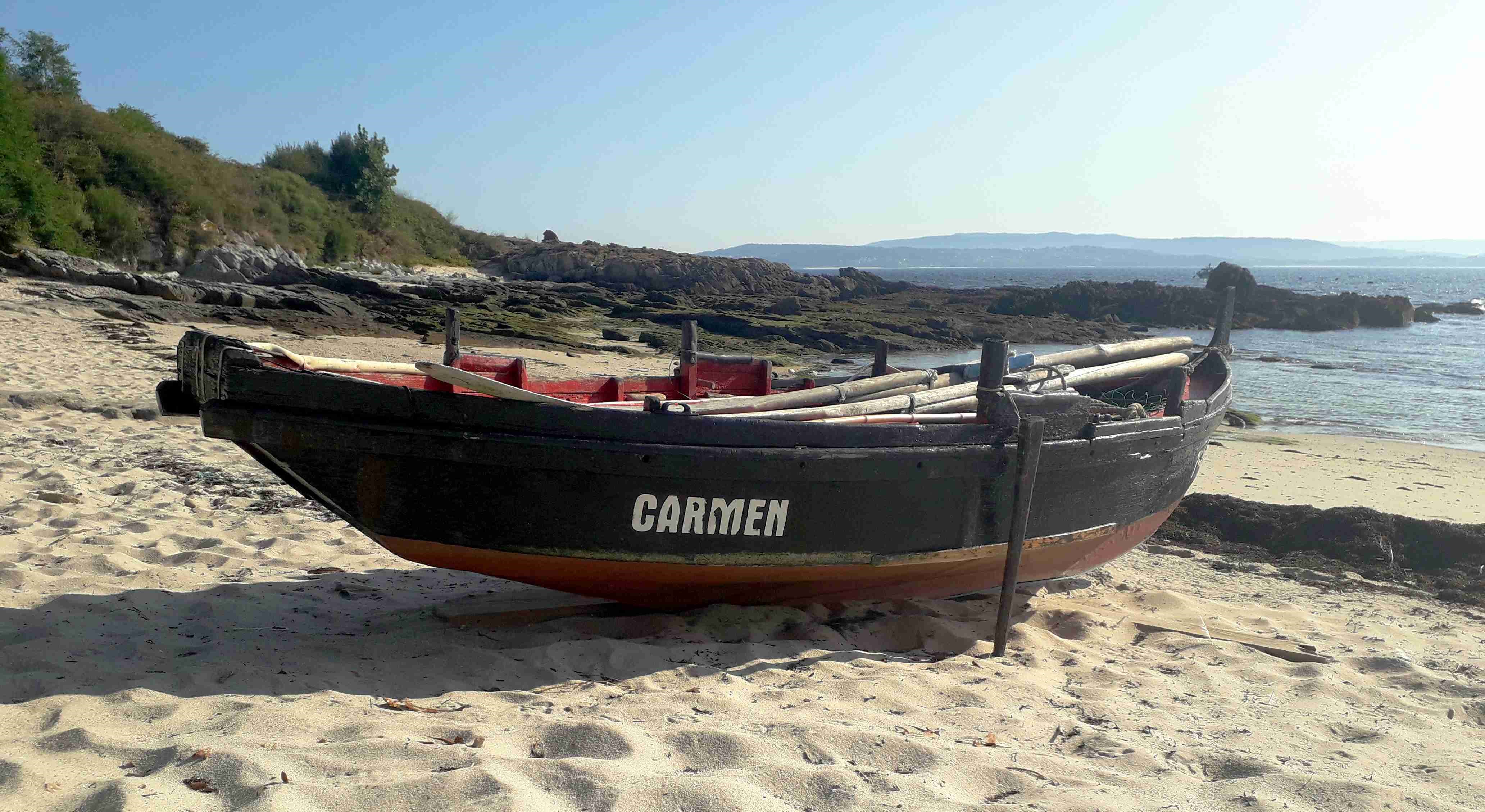
One of the island's last dornas, at Praia das Dornas (Dornas Beach).