The Park
The archipelagos of Cíes, Ons, Salvora, Cortegada, and the surrounding sea make up the characteristic contrasting landscape of the Galician Atlantic Islands Marine-Terrestrial National Park (GAIMTNP). Some of the most representative examples of Atlantic marine ecosystems that treasure immense biological wealth lie in the waters beneath them.
The islands, located at the mouth of the Rías Baixas, act as a natural barrier to the ocean and accentuate the estuarine environment of the rías, which are drowned lower portions of river valleys. Dune systems, cliffs, and gorse & heather bushes make up the terrestrial environment. Brown algae forests communities (Saccorhiza polyschides and Laminaria spp) are abundant in rocky seabed environments that provide shelter to a wide variety of living organisms. Sea currents deposit sand in the most sheltered areas and together with the abundant Maerl Beds (calcareous algal remains) form a mobile substrate medium to which living organisms like bivalves adapt by burying themselves to avoid being swept away by currents. This marine wealth of the park is covered by the Convention for the Protection of the Marine Environment of the North-East Atlantic (the 'OSPAR Convention').
Click here to download the full guide to the Park. 
| Marine area | Terrestrial area | Autonomous Region | Provinces | Municipalities | Creation | Special Protection Areas for Birds (SPAB) | Special Protection Areas (SPAs) | OSPAR Convention | RAMSAR Convention | PORN | PRUX | Cultural Interest Property (BIC) |
|
7.285,2 ha |
1.194,8 ha |
Galicia | A Coruña and Pontevedra |
Vigo, Bueu, Vilagarcía and Ribeira |
1st July 2002 (Law 15/2002) |
Cíes, Ons and surrounding sea of Sálvora |
Cíes, Ons and Sálvora |
Since 2008 |
Since 2021 |
Decree 274/1999 | Decree 177/2018 |
Sálvora island |
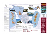
Maps and routes
Create your own map by selecting the archipelago and type of information that interests you: trails, spots to visit, services, etc... Remember to walk only along routes marked in colour.
Take a screen shot if you wish to print the same.
By clicking here, you can download a detailed description of the routes in the four archipelagos.
Click on this Library link, to consult and download maps and information about the islands.


