
If you prefer, you can download the complete self-guided route leaflet in PDF format HERE. ![]()
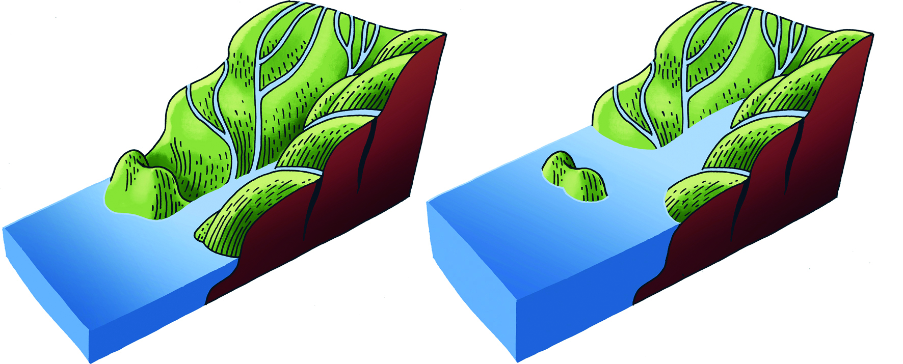
The formation of the rías also gave rise to this gently sloping island.
Did you know you're standing on the outermost extension of the mountains that form the Salnés Peninsula—the land between the Ría de Pontevedra and the Ría de Arousa?
Thousands of years ago, what is now the island of Ons was a coastal hill. Its isolation was caused by the sinking of the coastline due to slow movements of the Earth’s crust and, above all, by rising sea levels after the last Ice Age. Less than 6,000 years ago, coastal valleys were flooded to form the rías, coastal mountain ranges became peninsulas between them, and their outermost peaks became islands.
Although Ons may seem gently sloped when viewed from the ría, its highest point—at the lighthouse—reaches 119 meters. Other elevations, such as the one you’re climbing now, also approach 100 meters and this one is aptly named O Alto (“The Height”).